Plan and plot a danger bearing using a visible landmark and monitoring the bearing to that landmark on the GPS screen.
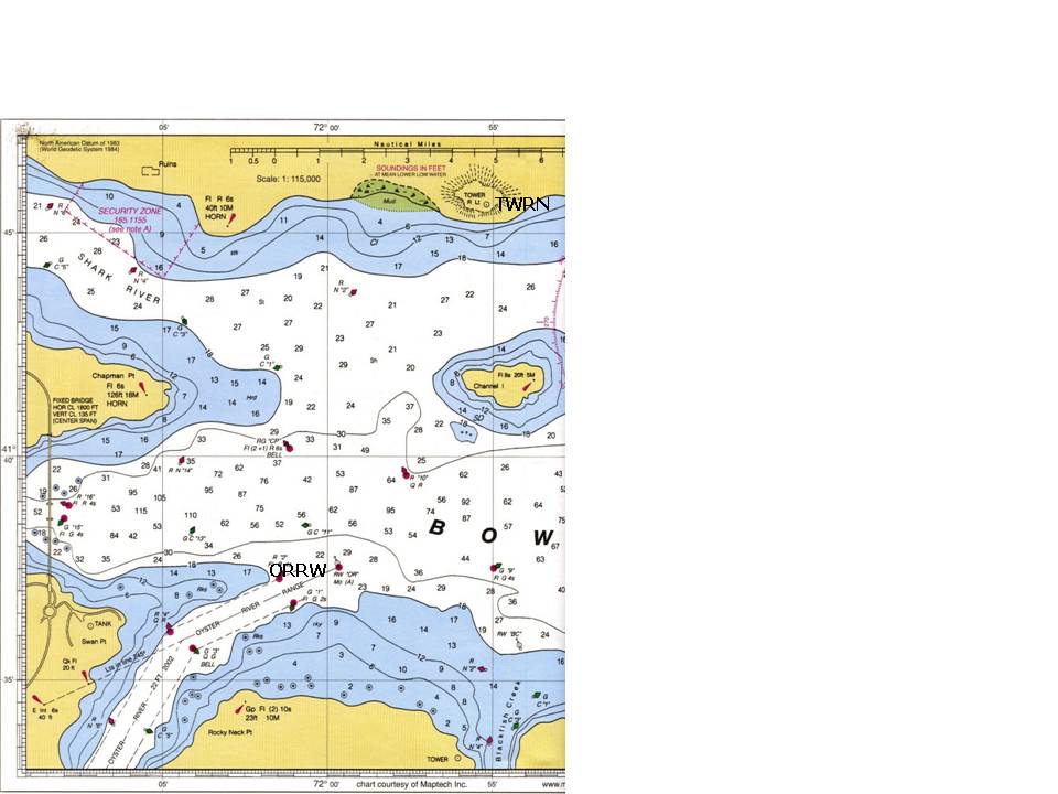
Establish and plot a waypoint “TWRN” at Tower R Lt north of Channel Island. Assume that this tower is 40 feet high. Establish and plot a waypoint “ORRW” at RW “OR” Mo “A” Oyster River.
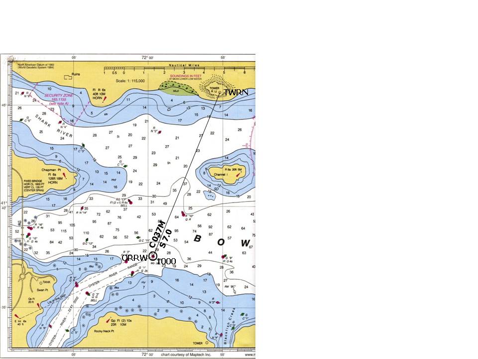
At 1000, you depart waypoint ORRW. “Go To” TWRN. Your speed is 7.0kn.
T = 022
V = 015W
M = 037
D =000
C =037
Plot and label the course.
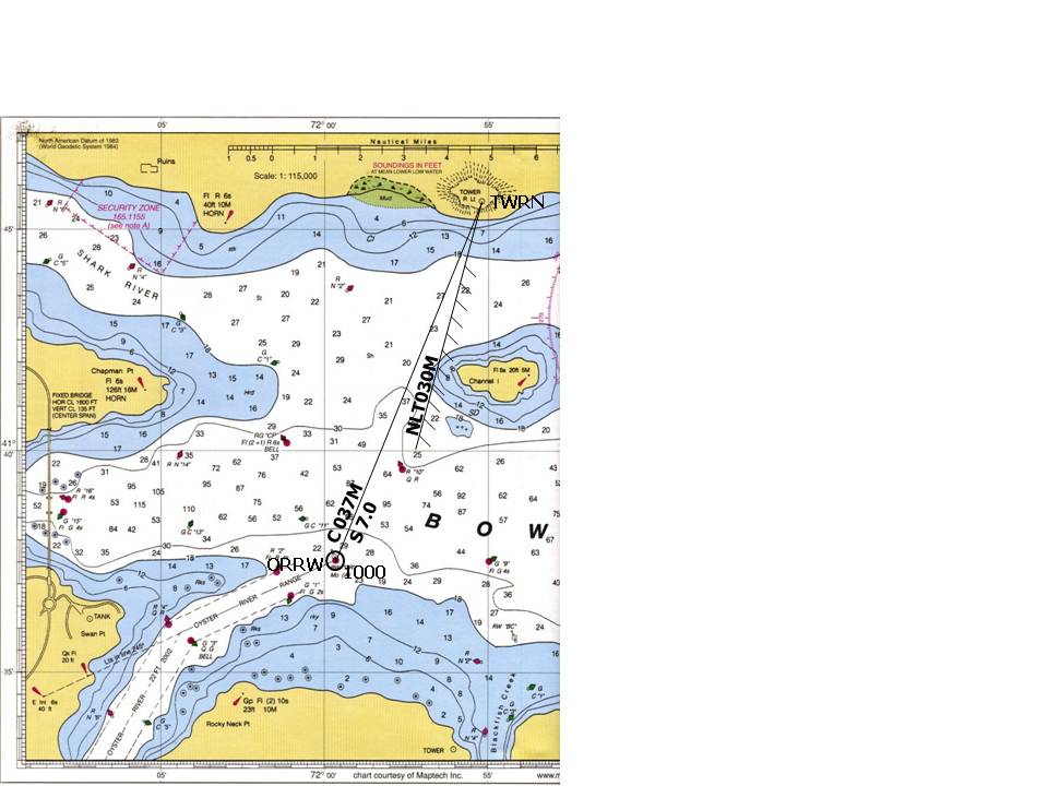
Plot a GPS danger bearing that will keep you west of Channel Island, coming no closer than the 12 foot sounding curve.
T = 015
V = 015W
M = 030
D =000
C =030
Draw the danger bearing
Determine the bearing of the danger bearing.
T = 015
V = 015W
M = 030
D =000
C =030
Draw and label the danger bearing – is it “not less than” or “not greater than”
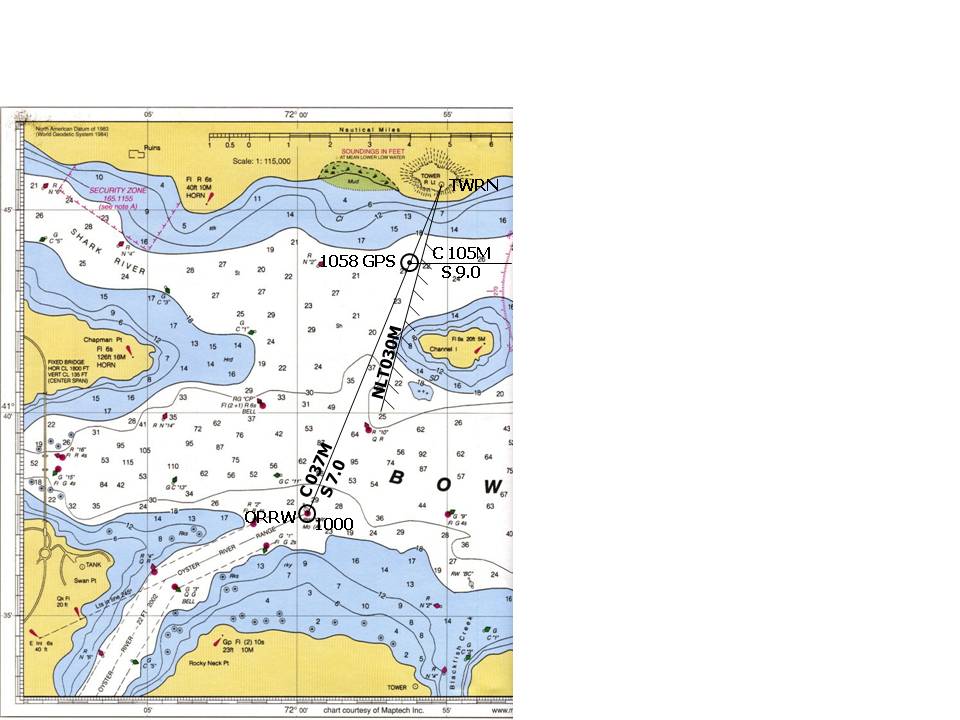
From this fix, take up a magnetic heading of 105 and increase speed to 9.0kn.
M = 105
V = 015W
T = 090
You always start a new course line from a fix.
At 1058, take a fix from your GPS screen when you reach a point 2.1nm from TWRN, with the waypoint bearing 037M.